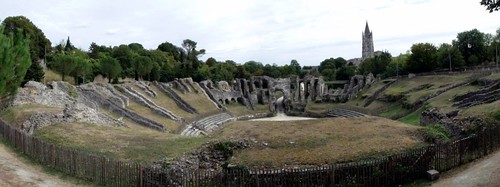
Well we knew nothing about the Saintes, except was also the closest large town to the campsite at Les Mathes and Dot had seen that there was a Roman Amphitheatre there.
I had picked out a car park to the east of and close to the river, from there it was only a short walk to the river.
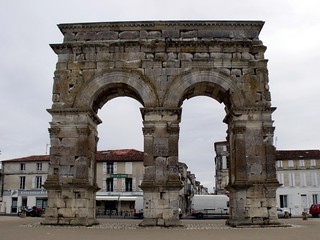
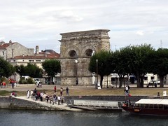
At the river there was a Roman Arch, The Arch of Germanicus and also a small museum of Roman ruins (not to mention toilets). The arch dates from 18 or 19 AD but was moved in 1843 and was restored in 1851. It looks like it has been put back together by armatures.
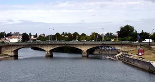
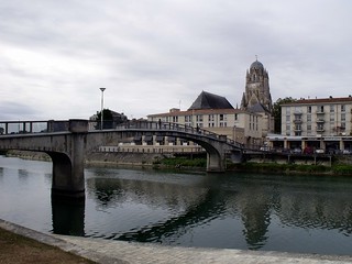
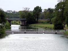
I got a street map from the tourist info there, at least we would know where we were going now. We had a look around the Roman artefacts, took photos of the road bridge and crossed over the river via the footbridge and into the town centre.
Dot foud on the map where the Roman amphitheatre was and we set off to find it. I had the map and knew the general direction and the were plenty of signposts pointing to it, although many of them were pointing different ways.
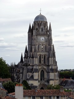
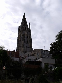
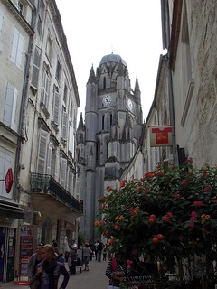
Off the bridge, it was straight onto Place Saint-Pierre, to the Cathédrale Saint Pierre and then onto Rue de l'Évêché via Place du Synode. Then right onto Rue Charles Dangibeaud and then Ruelle de l'Hospice, a very steep passageway up to Rue Bernard where we turned right again. The views of the Cathédrale from here are very good.
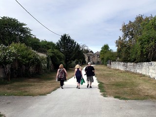
Rue Bernard continues round to the left to the main road. Cross over and follow the main road to the left to a pathway (signposted) down a hill through the trees. At the bottom the path turns to the right, the Basilique Saint-Eutrope can be seen high up to the left as we walked.
After a nice flat walk, there was quite a climb to get to the amphitheatre (good views from the top though) and then it was down the other side of the hill, only to climb another hill to get the entrance.
By the time we arrived at the amphitheatre there wasn't much time left to do the full tour, also we were getting hungry (we had left the picnic in the car). So we just had a walk around the outside and took photos over the fence, before heading back into the centre.
We continued round the outside of the amphitheatre and up another hill, Rue Bourignon, back towards the centre. At the end of Rue Bourignon, bear right onto Rue Saint-Macoult. Back at the main road it was straight over and back onto Rue Bernard. At the end of Rue Bernard we went down steps onto Rue des Jacobins.
Back down in the centre, we had a very brief look around the place and an even quicker look at the shops.
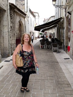
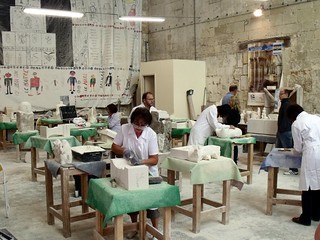
Then continued straight on to the river, we didn't stop long to shop but did look in at the cathedral stonemasons and watched the craftsmen/women for a wile. I have done this before near to York cathedral and I suppose there will be a stonemasons like it near every other big cathedral.
We then crossed back over the river to find the car and our lunch. I did take a few more bridge photos on the way back.
No comments:
Post a Comment