This is the first of the walks we have done around Cotherstone, for the other walks, we had a better idea of where we were going. You can start this walk in Cotherstone or as we did, from the Caravan Club Site.
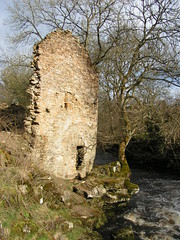
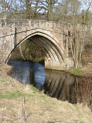
A beautiful morning at the Doe Park campsite just outside Cotherstone, so we decided to make a picnic and go for a walk along one of the many public footpaths, we could do with some OS (ordinance survey) maps, as we had no idea where any of them went. We set out down the dirt path from the site in the direction of the village, walking alongside the river Balder, passed the remains of what looked like an old watermill and then, crossed over the river at the road bridge.
We then turned left along the public right of way just over the bridge and headed towards the river Tees, this path is fairly slippery but not too bad, until it veers away from the river, around a house.
This part of the path was nearly impassable with beep mud but we managed to get through (this has now been resurfaced but beware), the rest of the way down to the confluence with the river Tees, is along a narrow road set back from the river Balder.
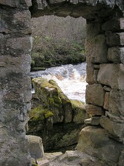
There were footbridges over both rivers and the Teesdale Way passed in all directions along both sides of the river Tees, this was slightly confusing as all of the direction signs said the same thing (Teesdale Way), in every direction. We crossed over the Balder via a footbridge, then another footbridge over the Tees, we then headed east along the river banks, this path soon took us up high above the river and eventually we turned back to the confluence, for our picnic lunch, on a nice seat overlooking the two rivers.

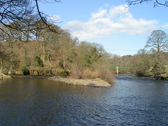
It was very good weather for our picnic, it was warm and the sun was shining, it was also a very good location for our picnic, with both rivers flowing past and not another human being in sight.
We had, had our lunch slightly early as Dot had read her watch wrong and it was now still only about midday, so we headed up into the village for a look round. We walked back along the path we came down and up a steep road into the village. We walked through the village and had a wander round what was presumably the village green, before heading back the way we came.
In the Village the Red Lion was still closed (you would have to see the write-up from the day previous) and this is lunch time remember, but the Fox and Hounds was open, so I made the tactical decision to have beer while I could. I got a Black Sheep and dot had a half lager, very nice it was and although we didn't have food there, what others were eating looked very good.
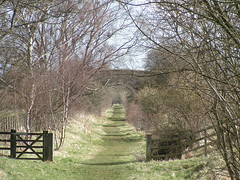
Only had the one and then continued with the walk, headed back towards the campsite but turned left before the bridge and walked along a country lane on the opposite side of the river Balder to the site. We had no idea where we were going but we had plenty of time, after about a mile we came across a bridleway following the path of an old disused railway. The Tees Valley Railway Path as it is known, follows the path of the old Barnard Castle to Alston line. The path starts near the village of Lonton, passing through or near Cotherstone, Romaldkirk, Mickleton and ends near Lartington.
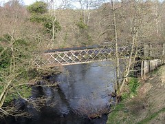
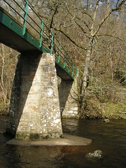
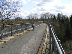
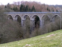
We had an Idea that this path would lead us back towards the campsite, we knew we had to cross over the river and hoped that the railway bridge was still there. What we didn't expect was a marvellous viaduct but there it was, crossing high above the river Balder, well worth the walk, if only to see and walk over this.
Just over the bridge another public footpath crossed Tees Valley Railway Path and a turn to the right took us back to the campsite.
No comments:
Post a Comment